| Namespace | eml://ecoinformatics.org/spatialRaster-2.2.0 | ||
|
Annotations
|
|
||
|
Diagram
|
 |
||
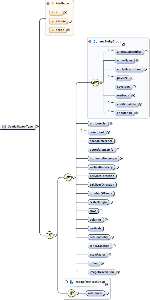
| Type | SpatialRasterType | ||
|
Properties
|
|
||
| Model |
(alternateIdentifier* , entityName , entityDescription{0,1} , physical* , coverage{0,1} , methods{0,1} , additionalInfo* , annotation* , attributeList , constraint* , spatialReference , georeferenceInfo{0,1} , horizontalAccuracy , verticalAccuracy , cellSizeXDirection , cellSizeYDirection , numberOfBands , rasterOrigin , rows , columns , verticals , cellGeometry , toneGradation{0,1} , scaleFactor{0,1} , offset{0,1} , imageDescription{0,1}) | (references)
|
||
| Children | additionalInfo, alternateIdentifier, annotation, attributeList, cellGeometry, cellSizeXDirection, cellSizeYDirection, columns, constraint, coverage, entityDescription, entityName, georeferenceInfo, horizontalAccuracy, imageDescription, methods, numberOfBands, offset, physical, rasterOrigin, references, rows, scaleFactor, spatialReference, toneGradation, verticalAccuracy, verticals | ||
|
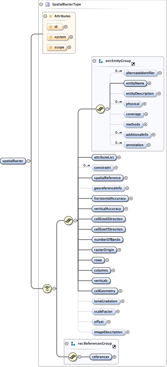
Instance
|
|
||
|
Attributes
|
|||
|
Source
|
|
||
| Schema location | file:/Volumes/mob/EML_schema/EML-2.2.0/git_checkouts/eml/tmp/eml-spatialRaster.xsd |